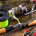
Introduction to Fishing Maps and Markers
In the world of American angling, technology has brought about a true revolution. Gone are the days when finding a prime fishing spot meant relying solely on word-of-mouth tips or hand-drawn maps passed down through generations. Today, maps and digital markers have transformed how anglers discover new locations, strategize their trips, and even share their favorite spots with friends. The use of navigation tools—from detailed topographic maps to GPS-enabled smartphone apps—has made it easier than ever for both novice and seasoned fishers to explore America’s vast lakes, rivers, and coastal waters with confidence.
By combining traditional map-reading skills with cutting-edge digital resources, anglers can access up-to-date information about water depths, underwater structures, fish habitats, and boat launches. Digital markers allow users to pinpoint hotspots, log memorable catches, and plan return visits—all at the tap of a screen. This fusion of old-school navigation and modern technology is empowering a new generation of anglers to maximize their time on the water and discover hidden gems across the country.
2. Understanding Different Types of Maps
To become a successful angler in the U.S., understanding the various types of maps and navigation tools available is crucial. Each type of map serves a unique purpose and can help you discover new and productive fishing spots, whether you’re casting from shore, paddling in a kayak, or boating on a vast reservoir. Below is an overview of the most commonly used maps by American anglers:
| Map Type | Description | How It Helps Anglers |
|---|---|---|
| Topographic Maps | These maps display elevation changes, land features, and terrain contours. They are often used for hiking and outdoor activities. | Topos help anglers identify access points, creek beds, drop-offs, and hidden ponds—perfect for scouting out new bank fishing locations or remote lakes. |
| Nautical Charts | Designed for navigation on large bodies of water, these charts show water depths, underwater hazards, buoys, and channels. | Nautical charts are essential for boaters targeting deep water species. They provide vital information about safe routes and reveal submerged structures where fish may gather. |
| Digital Map Apps | Apps like Google Maps, Navionics, or Fishbrain offer interactive features including GPS tracking, depth overlays, user-submitted hotspots, and weather updates. | Digital apps allow real-time navigation and sharing of waypoints or markers. Many American anglers use them to log catches, mark honey holes, and plan trips with friends. |
No matter your preferred fishing style or target species, leveraging the strengths of each map type can give you a major advantage. By layering information from these sources, you’ll be able to pinpoint productive areas faster and increase your chances of landing that trophy catch.
![]()
3. Essential Navigation Tools for Anglers
Whether youre fishing the backwaters of the Midwest or casting along the coasts, having the right navigation tools can make all the difference in finding productive fishing spots. American anglers rely on a blend of classic gear and cutting-edge technology to stay on track. Here’s a breakdown of the must-have navigation tools used across the U.S.:
Traditional Navigation Tools
Before technology took over, anglers depended on basic yet reliable equipment:
| Tool | Use | Why It Matters |
|---|---|---|
| Compass | Determines direction | Essential for orienting maps and navigating remote areas without electronics |
| Paper Maps (Topographic/Waterway) | Show physical features and water bodies | Provide a broad overview and backup if digital devices fail |
Modern Electronic Devices
The digital age has revolutionized how American anglers navigate both familiar and new waters:
| Device | Popular Brands/Apps | Main Features |
|---|---|---|
| Handheld GPS Units | Garmin, Lowrance, Humminbird | Accurate location tracking, waypoint marking, route planning, waterproof designs |
| Fishfinder/GPS Combos | Humminbird HELIX, Lowrance HDS | Sonar mapping, real-time fish locations, depth charts, integrated mapping tools |
Smartphone Apps for Anglers
Your phone can be just as valuable as a rod and reel. Many U.S. anglers use dedicated apps to plan trips and mark hot spots:
| App Name | Main Use | Cultural Relevance in the U.S. |
|---|---|---|
| Navionics Boating | Nautical charts, GPS tracking, waypoint saving | A favorite among boaters and kayak anglers for its detailed mapping of U.S. lakes and coasts |
| Fishbrain | Crowdsourced fishing reports, map-based catch logs | Packed with community tips—anglers share exact locations and species caught across America |
Navigating Like a Local: Pro Tips
- Always have a backup—paper maps don’t run out of battery!
- Mark your entry and exit points, especially when fishing unfamiliar lakes or rivers.
- Update your device’s maps regularly to reflect changing waterways or access points.
- If using apps, consider offline map downloads for remote areas with spotty cell service.
The Bottom Line
No matter if you’re old-school or all-in on tech, combining these tools ensures you’ll spend less time searching—and more time catching—at America’s best fishing spots.
4. How to Use Markers and Waypoints
Mastering the use of markers and waypoints is a game-changer for anglers who want to consistently find and return to productive fishing locations. Whether you’re working with advanced GPS units or sticking with tried-and-true paper maps, knowing how to set, manage, and organize these crucial points can elevate your fishing experience across any body of water in the United States.
Setting Waypoints on Digital Devices
Modern fish finders, smartphones, and handheld GPS devices come packed with waypoint features. To get started:
- Identify the Spot: When you catch fish or notice promising underwater structure, hit the “mark” or “waypoint” button on your device.
- Name Your Waypoint: Give each point a unique label, such as “Bass Ledge” or “Crappie Hole,” and consider adding details like depth or lure choice in the notes section if available.
- Organize by Category: Most devices let you color-code or sort waypoints by species or season for quick reference during future trips.
Managing Markers on Paper Maps
If you prefer old-school navigation, markers are just as effective. Here’s how to stay organized:
- Use Waterproof Markers: Write directly on laminated maps to highlight favorite spots. Colored dots or symbols can differentiate hot spots from navigation hazards.
- Create a Legend: Develop a simple key that explains what each mark means (e.g., red for largemouth bass, blue for panfish).
- Date Each Entry: Record when and under what conditions each location produced fish—this builds valuable long-term knowledge.
Comparison Table: Digital vs. Paper Markers
| Feature | Digital Devices | Paper Maps |
|---|---|---|
| Ease of Use | High (one-touch marking) | Moderate (manual marking) |
| Organization | Custom folders, colors, notes | Legend and color-coding required |
| Durability | Affected by battery life/weather | Laminated maps resist elements |
| Sharing with Friends | Email/text waypoints easily | Share physical copies only |
| Edit/Remove Points | Edit/delete anytime digitally | Scribble out or re-mark manually |
Troubleshooting Common Issues
If you lose track of your waypoints or markers—whether digital or paper—always back up digital data online and take photos of annotated paper maps. For best results, regularly update your waypoints after every trip so you always have the latest info at hand.
The careful use of both markers and waypoints ensures that your hard-earned fishing knowledge is never lost, making every outing more productive and enjoyable for American anglers of all skill levels.
5. Popular Map and Marker Apps in the U.S.
When it comes to finding the best fishing spots in the United States, anglers are increasingly turning to digital tools that offer interactive maps, community features, and reliable navigation. Here’s a closer look at some of the most popular apps—Fishbrain, Navionics, and Google Maps—and how their unique features help American anglers collaborate and share locations responsibly.
Top Fishing Apps for Mapping and Marking Spots
| App Name | Main Features | Community Collaboration | Responsible Sharing Tools |
|---|---|---|---|
| Fishbrain | User-generated fishing spots Detailed catch logs Species forecasts |
Social network for anglers Spot sharing with friends Comment & advice threads |
Private location options Sensitive spot protection Report inappropriate markers |
| Navionics | Marine charts Sonar chart overlays Waypoint marking |
Community edits on maps Sharing custom routes User reviews on locations |
Edit history tracking Password-protected waypoints Data privacy controls |
| Google Maps | Aerial & street views Custom pin drops Driving directions |
Create shared lists with friends or groups Add photos & notes to markers Public or private sharing options |
Easily remove or edit pins User reporting for sensitive areas No automatic public sharing |
The Importance of Responsible Spot Sharing
The popularity of these apps highlights a growing trend in American angling culture: using technology not only to discover new waters but also to build supportive, informed communities. By choosing apps with robust privacy settings and responsible sharing features, anglers can enjoy discovering prime fishing locations while protecting sensitive habitats and respecting local regulations. This blend of innovation and stewardship ensures that both seasoned pros and weekend hobbyists can find—and preserve—the best fishing spots for years to come.
6. Tips for Finding Productive Fishing Locations Safely
As you use maps and markers to discover the best fishing spots across America, it’s essential to do so with a focus on safety, respect for local regulations, and an understanding of the terrain. Here are some key tips to help ensure your next fishing adventure is both productive and secure.
Reading Terrain Like a Pro
Understanding how to interpret land and water features on maps can make or break your fishing trip. Look for:
| Terrain Feature | What It Indicates | Fishing Potential |
|---|---|---|
| Drop-offs/Shelves | Sudden depth changes near shorelines or underwater ledges | Great for targeting bass, walleye, and catfish that ambush prey here |
| Coves/Inlets | Sheltered areas where water flows in/out | Often hold panfish, trout, and spawning species |
| Points/Protrusions | Narrow strips of land jutting into water bodies | Attract fish due to current changes and baitfish gathering |
| Weed Beds/Vegetation | Areas marked as aquatic plant growth on satellite maps or charts | Pike, largemouth bass, and bluegill love these habitats |
Checking Local Regulations Before You Cast
No matter how promising a location looks on your map app or GPS device, always check the local fishing regulations before heading out. U.S. states have unique rules regarding:
- Licensing: Most states require anglers to carry a valid fishing license.
- Seasonal Restrictions: Some waters are closed during spawning or sensitive periods.
- Bait & Tackle Limits: Live bait bans or hook restrictions may apply in certain areas.
- Catch Limits: Bag and size limits protect fish populations—know them before you keep anything.
You can find up-to-date information on official state wildlife agency websites or by scanning QR codes often posted at popular boat ramps and trailheads.
Navigating New Waterways Safely
Your personal safety is just as important as finding fish. When exploring unfamiliar American waterways, follow these guidelines:
- Tell Someone Your Plan: Share your intended route and return time with a friend or family member.
- Bring Safety Gear: Always wear a life jacket when boating or wading; pack a first aid kit, whistle, and flashlight.
- Check Weather Conditions: Use weather apps to avoid storms or sudden temperature drops common in U.S. climates.
- Avoid Private Property: Respect “No Trespassing” signs—many lakes and streams cross private land boundaries.
- Be Bear & Wildlife Aware: In regions like the Rockies or Appalachians, store food securely and know what to do if you encounter wildlife.
Your Adventure Awaits—Fish Smart!
The combination of smart navigation tools, respect for regulations, and safety-first thinking will lead you to some of America’s most rewarding fishing spots. Whether you’re chasing trophy bass in Texas reservoirs or casting for trout in Montana streams, let maps and markers guide you—responsibly—to your next big catch.