1. Understanding the Basics of Fish Finders
If youre looking to up your fishing game, understanding how fish finders work is a great place to start. These devices use sonar technology to help you locate fish, underwater structures, and changes in water depth—making them essential tools for serious anglers.
How Sonar Technology Works
Sonar stands for Sound Navigation and Ranging. Fish finders send out sound waves (or “pings”) into the water. When these waves hit something like a fish, rock, or the lake bottom, they bounce back to the device. The fish finder then uses this return signal to create a visual image on your screen. The stronger and faster the return signal, the closer and denser the object is.
Types of Sonar Imaging
Modern fish finders offer several types of sonar imaging, each with its own strengths. Here’s a quick breakdown:
| Type | Description | Best For |
|---|---|---|
| 2D Sonar | Traditional sonar with cone-shaped beams that provide real-time feedback in simple color displays. | General fishing in shallow or medium-depth waters. |
| Down Imaging | High-frequency sonar that gives detailed images directly beneath your boat. | Identifying structure and fish under your vessel with clarity. |
| Side Imaging | Sends sonar beams out to both sides of your boat for wide-angle views. | Scanning large areas quickly; ideal for finding schools of fish or submerged features. |
What Sets Modern Fish Finders Apart
Today’s fish finders are more advanced than ever. Many come equipped with GPS mapping, CHIRP sonar (which sends a range of frequencies instead of just one), and touchscreen interfaces. Some models even sync with smartphone apps or support real-time mapping while you’re on the water. This tech gives you more control, better visuals, and greater chances of landing that trophy catch.
Key Features to Look For:
- CHIRP Sonar: Offers clearer images by using multiple frequencies at once.
- GPS Integration: Helps mark hotspots and navigate unfamiliar waters.
- Wi-Fi/Bluetooth Connectivity: Syncs data with mobile devices or updates software easily.
- High-Resolution Displays: Makes it easier to read underwater details in sunlight or low light.
The right fish finder can turn a good day on the water into an unforgettable one. Knowing how each feature works helps you make smarter decisions before you even cast a line.
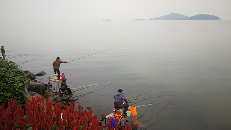
2. Choosing the Right Fish Finder for Your Fishing Style
When it comes to fish finders, one size definitely doesn’t fit all. Whether youre chasing bass in a freshwater lake, stalking redfish along the saltwater flats, or heading offshore for tuna, the right fish finder can make a world of difference. Let’s break down how to match your device to your fishing style.
Freshwater Fishing
If you spend most of your time on lakes and rivers, you’ll want a fish finder that offers high detail at shallower depths. Look for units with CHIRP sonar and GPS mapping to help you mark productive spots and structure like drop-offs, weed beds, or submerged trees.
Recommended Features:
- High-frequency CHIRP sonar (83/200 kHz)
- Built-in GPS with lake maps
- Down imaging for clear bottom views
- Compact display (5–7 inches) for small boats or kayaks
Saltwater Inshore Fishing
Fishing coastal waters brings different challenges—tidal changes, varying bottom types, and more boat traffic. You’ll need a more rugged unit with better depth penetration and side imaging to scan wider areas.
Recommended Features:
- Medium-frequency CHIRP sonar (50/200 kHz)
- Side imaging to locate fish along channels and flats
- Weather-resistant design
- Tide and current data integration
Offshore Fishing
If youre heading miles out into the ocean targeting big game species like marlin or mahi-mahi, you’ll need top-tier sonar technology. Deep water requires low-frequency sonar and powerful transducers capable of reaching depths over 1,000 feet.
Recommended Features:
- Dual-frequency CHIRP (50/200 kHz or lower)
- Powerful transducer (1kW or more)
- Large display (9 inches or more) with split-screen capability
- NMEA network compatibility for radar and autopilot integration
Quick Comparison Table
| Fishing Environment | Best Sonar Type | Screen Size | Key Features |
|---|---|---|---|
| Freshwater Lakes & Rivers | High-Frequency CHIRP, Down Imaging | 5–7 inches | GPS Mapping, Structure Scan |
| Saltwater Inshore | Medium-Frequency CHIRP, Side Imaging | 7–9 inches | Tide Data, Weatherproof Design |
| Offshore Deep Sea | Low-Frequency CHIRP, Dual Frequency | 9+ inches | NMEA Integration, Deep-Water Reach |
Selecting the right fish finder isn’t just about brand names or screen size—it’s about how well the features align with where and how you fish. By choosing a unit tailored to your fishing environment, you’ll gain clearer images, better precision, and ultimately catch more fish.
![]()
3. Breaking Down the Display: Reading Sonar Like a Pro
Understanding what your fish finder is showing you is key to turning sonar signals into successful catches. The screen might look like a confusing mess of colors and lines at first, but once you know what youre looking at, youll be able to tell the difference between a trophy bass and a sunken log.
How Sonar Returns Work
Your fish finder sends out sound waves (sonar) that bounce off objects underwater and return to the transducer. The unit then translates these echoes into visual data on your display. The strength and timing of these returns help determine how deep something is and what its made of.
Key Elements on Your Display
| Element | Description |
|---|---|
| Fish Arches | Curved shapes indicating moving fish; full arches suggest fish passed directly under the transducer. |
| Structure | Solid, consistent shapes like trees, rocks, or man-made debris; often appear as clusters or sharp edges. |
| Bait Balls | Cloud-like formations that represent schools of baitfish; usually found near predatory fish. |
| Bottom Line | The thick line at the bottom of your screen showing lake or ocean floor; color/thickness varies by hardness. |
Distinguishing Fish from Structure
This is where practice makes perfect. Fish typically appear as arches or small dots depending on their movement and size. If youre seeing consistent shapes that don’t change over time, you’re likely looking at underwater structure. Watch for isolated arches near structure — those are often gamefish waiting to ambush prey.
Reading Bottom Composition
The bottom line on your sonar tells you more than just depth. A thick, bright return usually means a hard bottom (rock or gravel), while a thin or faint line indicates soft bottom (mud or vegetation). Understanding this helps you choose the right lure and presentation style based on habitat preferences of target species.
Bottom Composition Clues
| Display Appearance | Likely Bottom Type |
|---|---|
| Thick, solid line with strong echo return | Hard bottom (rock, gravel) |
| Thin line with weak echo return | Soft bottom (mud, silt) |
| Uneven or jagged edge with shadows | Weed beds or submerged timber |
Tuning Settings for Better Reads
If your sonar image looks too cluttered or too empty, try adjusting sensitivity and contrast settings. Increase sensitivity to pick up faint signals in deeper water; lower it when theres too much noise from debris or plankton. Use zoom features to focus on specific depth ranges where fish are holding.
Pro Tip:
If you’re fishing in unfamiliar waters, spend a few minutes cruising around slowly while watching your display. Mark areas where bait balls and good structure overlap — thats prime real estate for big fish.
The more time you spend reading your fish finder, the more second-nature it becomes. Treat it like learning a new language — one that speaks in pings and echoes instead of words.
4. Advanced Settings and Tuning Techniques
Once you’ve got the basics of your fish finder down, it’s time to take things up a notch. Fine-tuning advanced settings like sensitivity, frequency, and range can make a huge difference in how accurately your sonar reads underwater activity. Whether you’re fishing shallow lakes or deep offshore waters, adjusting these settings based on conditions and your target species helps you spot more fish—and waste less time.
Sensitivity: Finding the Sweet Spot
Sensitivity controls how much detail your fish finder displays. Higher sensitivity picks up more signals—including small baitfish and structure—while lower sensitivity filters out clutter. The key is balancing clarity with readability:
| Water Condition | Recommended Sensitivity | Why It Works |
|---|---|---|
| Clear, calm water | High (80–100%) | Reveals detailed structure and smaller fish targets |
| Muddy or turbulent water | Medium (50–70%) | Reduces noise and false readings caused by debris |
| Deep water (>100 ft) | High (90–100%) | Ensures returns from greater depths are picked up clearly |
Frequency: Match It to Your Mission
Your fish finder’s transducer uses sonar frequencies—usually measured in kilohertz (kHz)—to scan the water. Different frequencies are better for different depths and types of fishing:
| Frequency (kHz) | Best For | Benefits |
|---|---|---|
| 200 kHz+ | Shallow water, inland lakes | Crisper detail and faster refresh rate; great for structure and panfish |
| 83–100 kHz | Medium-depth freshwater or saltwater | A balance between depth reach and resolution |
| 50 kHz | Deep sea or offshore fishing | Pierces deeper into water but with less detail; ideal for large species like tuna or grouper |
Range Settings: Zoom In on the Action
The range setting determines how deep your sonar scans. Auto mode is handy, but manual adjustments help when targeting specific depth zones where certain fish hang out:
Selecting the Right Range Manually
- Bass fishing in 10–20 ft of water? Set your range to max out at around 30 ft for clearer bottom separation.
- Trolling over a ledge at 60 ft? Set your range from 40–80 ft to focus only on that strike zone.
- Going deep-sea? A wider range (e.g., up to 600 ft) ensures you don’t miss big fish hugging the bottom.
Pro Tip:
If your screen looks cluttered or too empty, tweak the range or sensitivity first before changing other settings.
Tuning Takes Practice—but Pays Off Big Time
No two days on the water are exactly alike. Water clarity, temperature, bottom structure, and even boat speed all affect how your sonar performs. Don’t be afraid to experiment with different combinations of settings until you find what works best for the conditions—and the fish—you’re after.
The more time you spend dialing in these advanced features, the more confident you’ll be reading what’s really going on below the surface. That edge can turn a slow day into an unforgettable one.
5. Integrating GPS and Mapping for Smart Fishing
Modern fish finders have come a long way from just showing whats below your boat. Today’s high-tech models combine sonar technology with GPS and detailed mapping features, giving anglers a powerful edge on the water. By understanding how to use these tools together, you can mark hot spots, track fish movements, and plan your day more efficiently.
Why GPS Integration Matters
GPS in your fish finder does more than show your location—it helps you navigate unfamiliar waters safely and return to productive fishing spots with pinpoint accuracy. Whether youre exploring a new lake or heading back to a honey hole, GPS ensures you stay on course.
Key Benefits of GPS-Enabled Fish Finders:
| Feature | How It Helps |
|---|---|
| Waypoint Marking | Save exact locations where fish were biting, underwater structures, or hazards. |
| Route Tracking | Create and follow specific paths across the water to cover areas methodically. |
| Return Navigation | Easily find your way back to productive spots or the dock—even in low visibility. |
Using Topographic Maps to Your Advantage
Many modern fish finders come preloaded with topographic maps of lakes, rivers, and coastal areas. These maps show depth contours, drop-offs, submerged structures, and vegetation lines—clues that help identify where fish are likely hiding.
What to Look For on Maps:
- Drop-offs: Sudden changes in depth often attract baitfish and predators.
- Underwater Humps: Fish like to hang around elevated structures beneath the surface.
- Weed Beds: Good cover for bass and other species during warmer months.
Building a Smart Fishing Strategy
The real magic happens when you combine sonar data with GPS mapping. For example, if your sonar shows suspended fish over a deep structure, you can mark that spot as a waypoint and return later—or build an entire route that hits multiple promising spots throughout the day. Over time, these saved waypoints create a personal map of productive areas based on real experience.
Pro Tip:
If your fish finder supports custom map creation or community-shared maps (like C-MAP Genesis or Navionics), take advantage of it! These tools allow you to update outdated maps or add local fishing knowledge directly into your system.
By mastering GPS integration and mapping features in your fish finder, you’ll not only catch more fish—you’ll also spend less time guessing and more time casting.